 MineArchive
Wheal Regent
| Location | In the Crinnis Woods at Carlyon Bay, two miles east of St Austell and south of the main railway line., Cornwall — 50.3377, -4.7406 (approximate) |
|---|---|
| Commodities | Copper, Pyrite |
| Type | Metal |
| Worked | 1809–1855 |
| Maximum depth | Unknown. |
Overview
A copper mine opened in the Crinnis Woods east of St Austell within months of the Crinnis discovery of 1809 and named for the Prince Regent, later absorbed into the larger West Crinnis sett; its workings run under the houses of Carlyon Bay.
History
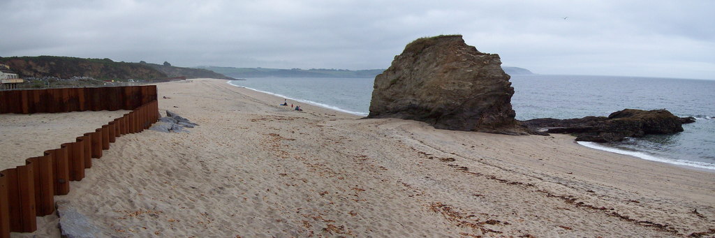
The discovery of copper at Great Crinnis in 1809 made fortunes and drew money into every sett around St Austell. Within months another mine was opened close by in the Crinnis Woods, and the workings became known as Wheal Regent after the Prince Regent, later King George IV. Between 1815 and 1823 it sold 2,623 tons of copper ore at seven per cent. The sett lay south of what became the main railway line, two miles east of St Austell. The older Wheal Regent workings were later taken into a larger sett called West Crinnis, which between 1855 and 1859 sold 1,665 tons of copper ore at 7.5 per cent, thirteen tons of pyrite and three tons of lead ore at 66 per cent carrying a little silver. Nothing of the mine is to be seen: the surface was levelled and bungalows built over it, in a road named Regents Close, and the workings extend under much of the residential part of Carlyon Bay. For some years one of the shops at Carlyon Bay traded as the Wheal Regent Restaurant.
Geology
Copper ore of about seven per cent, with pyrite and a little argentiferous lead recorded from the larger West Crinnis sett that absorbed it.
Workings
The Regent Shaft stood south of the main railway line, in the Crinnis Woods. The workings run beneath much of the residential part of Carlyon Bay.
Closure
Wheal Regent ceased to be worked under its own name when it was taken into the West Crinnis sett, which sold copper ore between 1855 and 1859.
What remains
Nothing of the mine survives at the surface; the ground is built over.
The surface remains were levelled and bungalows built on the site, in a road called Regents Close.
Related mines
- Cuddra Mine — Another St Austell copper mine worked on the Crinnis lodes in the same years.
- Great Crinnis Mine — The mine whose 1809 discovery brought Wheal Regent into being a few hundred yards away.
- West Crinnis Mine — The older working in the Crinnis Woods that this sett took in, and the source of the name Regents Close.
Nearby mines
- Great Crinnis Mine — 0.3 km E
- West Crinnis Mine — 0.4 km W
- Carclaze Pit — 3.4 km NW
- Fowey Consols — 5.0 km NE
- Wheal Martyn China Clay Works — 5.1 km N
Straight-line distance, within 15 km. Show on the map.
Recorded claims
Individual factual claims, each attached to the source(s) that support it below. Where sources disagree, both are kept.
- Wheal Regent was opened in the Crinnis Woods within months of the rich copper discovery at Crinnis in 1809 and named after the Prince Regent, later King George IV. 1,2
- Between 1815 and 1823 Wheal Regent sold 2,623 tons of copper ore at seven per cent. 2
- The earliest workings, known as Wheal Regent, were later taken into a larger sett called West Crinnis, which sold 1,665 tons of copper ore, thirteen tons of pyrite and three tons of lead ore between 1855 and 1859. 2
- The mine lay two miles east of St Austell, south of the main railway line, at about SX 050 523. 2,3
- The surface remains have been levelled and bungalows built over them in a road called Regents Close, the workings running under much of the residential part of Carlyon Bay. 2
- mindat records the Regent Shaft as lying south of the railway two miles east of St Austell, in woods, at SX 050 523, and gives the sett's output as 2,623 tons of copper ore between 1815 and 1823 before it was included in the West Crinnis sett. 3
- Chalcopyrite and pyrite are recorded from Wheal Regent, both from the Gus Horsley collection. 3
Photographs & further reading
The output figures for Wheal Regent and for the West Crinnis sett that absorbed it, and what became of the ground.
View sourceThe Crinnis discovery and the rush of mines it set off around St Austell, Wheal Regent among them.
View sourceThe locality record: the Regent Shaft south of the railway in woods, the grid reference and coordinates, the 1815-23 output, the later inclusion in the West Crinnis sett, and chalcopyrite and pyrite from the Gus Horsley collection.
View sourceSources
- (secondary) Joshua Rowe and the Great Crinnis Copper Mine 1809 (Lyndon Allen, 2026) — Charlestown Tours
- (secondary) West Crinnis Mine, Cornwall — Cornwall Calling
- (secondary) Wheal Regent, West Crinnis Mine, Carlyon Bay, Cornwall — Mindat (Hudson Institute of Mineralogy)
Record created: 23 September 2026 · Last researched: 24 September 2026