 MineArchive
Colsterdale Colliery
| Also known as | Thorney Grain Colliery, High Gill Colliery |
|---|---|
| Location | Head of Colsterdale, west of Masham, North Yorkshire |
| Commodity | Coal |
| Type | Coal |
| Worked | from By 1400 |
| Maximum depth | Unknown. |
Overview
The coal pits of Colsterdale, the 'coalman valley' west of Masham, worked in the Woogill coal from at least the fourteenth century; the High Gill workings at Thorney Grain gave fire coal, the Brown Beck pits mainly lime coal.
History
Colsterdale, the valley of the River Burn west of Masham, takes its name, first recorded in 1281, from its colliers: it means 'coalman valley'. There was a coal mine there in the fourteenth century, and in the Middle Ages much of the valley's coal mining was under the control of the monks of Jervaulx Abbey. A coal road links the mining area at the head of the valley with Gollinglith and Masham.
The seam worked was the Woogill coal, near the base of the Red Scar Grit. In the High Gill workings, at Thorney Grain, it was usually 16 to 20 inches thick, sometimes nearer 12, and of better quality, so that those pits produced more fire coal than lime coal. At Brown Beck, where the same seam dips gently east and was also worked on Braithwaite Moor and at Sowden Beck in East Witton township, the coal was 10 inches thick near the Low Shaft and 18 inches near the High Shaft, and the output was principally lime coal. The seam was also tried at Arnagill, six kilometres south-east of High Gill, but was soon given up as uneconomic.
Geology
The Woogill coal near the base of the Red Scar Grit, 10 to 20 inches thick.
Workings
Shafts at High Gill (Thorney Grain) and Brown Beck (Low and High Shafts), with workings on Braithwaite Moor and at Sowden Beck; a trial at Arnagill.
Closure
Unknown.
What remains
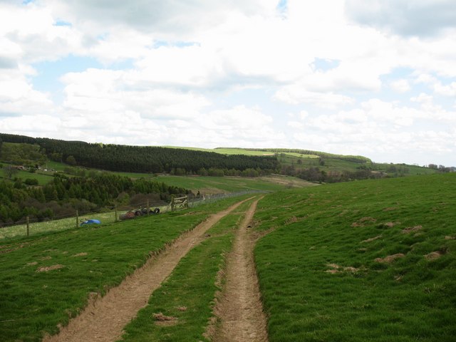
The coal road from the mining area at the head of the valley to Gollinglith and Masham survives as a track.
The Colsterdale coal road.
Redevelopment
Unknown.
Recorded claims
Individual factual claims, each attached to the source(s) that support it below. Where sources disagree, both are kept.
- Colsterdale, first recorded in 1281, means 'coalman valley'; there was a coal mine there in the fourteenth century. 1
- Much of the valley's coal mining was under the control of the monks of Jervaulx Abbey in the Middle Ages; a coal road links the mining area with Gollinglith and Masham. 2
- The Woogill coal was worked extensively; at High Gill, Thorney Grain, it was 16 to 20 inches thick and gave more fire coal than lime coal. 3
- The Brown Beck pits produced principally lime coal from a seam 10 to 18 inches thick. 3
Sources
- (secondary) Colsterdale — Wikipedia
- (observational) The Colsterdale Coal Road (Geograph 1276111) — Geograph
- (secondary) Colsterdale Colliery — Northern Mine Research Society
Record created: 17 October 2026 · Last researched: 17 October 2026