 MineArchive
Prestonhill Quarry
| Also known as | Preston Hill Quarry |
|---|---|
| Location | Beside Inverkeithing Bay, Inverkeithing, Fife — 56.0281, -3.3873 (exact) |
| Commodity | Whinstone |
| Type | Quarry |
| Worked | 1896–1980s |
| Maximum depth | Unknown. The flooded excavation is about 11 m deep as a body of water. |
Overview
A dolerite quarry on the shore of Inverkeithing Bay, worked from 1896 for close to a century and shipped out from its own pier. Perhaps two million cubic metres of rock were taken from it. Since it closed in the 1980s the excavation has filled with water eleven metres deep, and the flooded quarry has become both a diving training site and a place where people have repeatedly drowned.
History
Quarrying for dolerite began at Prestonhill in 1896 and continued for nearly a century, an estimated two million cubic metres of rock being removed over that time. The quarry stands immediately beside Inverkeithing Bay, an inlet of the Firth of Forth, and had its own loading pier opposite the workings — the reason for its position, since the stone could go out by sea.
Working ceased in the 1980s and the excavated ground filled with water. In 2022 plans were put forward to build 180 houses on the 44-acre site; they were refused in 2025 because of the adverse impact on Inverkeithing and the surrounding natural heritage, and the site was advertised for sale that June.
Geology
The quarry worked dolerite — a hard, dark, fine-grained intrusive igneous rock, the same material called whinstone in the Scottish and northern English quarrying trade, valued for roadstone because of its strength. It sits among the igneous rocks of the Forth shore at Inverkeithing, and the faces it left are rock cliffs bounding what is now a deep pool.
Workings
An open quarry cut down beside the bay, with a loading pier across from the workings so that stone could be taken away by water. The excavation reached below the water table, and once pumping stopped it filled to form a pond about eleven metres deep bounded by rock cliffs.
Closure
Quarrying ceased during the 1980s after nearly a century of working; no more precise closure date is recorded. The excavation then filled with water.
What remains
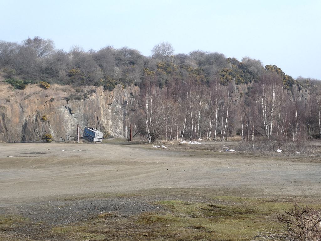
A flooded quarry about eleven metres deep, bounded by rock cliffs, on the Fife Coastal Path and used as recreation ground with walking paths above and below the workings. The former loading pier opposite the quarry still stands. The water is a fishing spot and an important diving training facility, used by the fire and rescue service and by the Royal Navy. It has also drawn swimmers and cliff-jumpers, and that has repeatedly proved fatal. Redevelopment for housing was refused in 2025 and the site was put up for sale that June.
The quarry faces and the flooded excavation, with the former loading pier standing opposite across the water.
Nearby mines
- Fairykirk Quarry — 0.4 miles (0.7 km) SW
- Dalmeny No. 2 and 3 Pits — 3.4 miles (5.5 km) S, West Lothian
- Duddingston No. 1 and 2 Mines — 3.8 miles (6.2 km) SW, West Lothian
- Cuttlehill Colliery — 4.2 miles (6.7 km) N
- Halbeath Colliery — 4.1 miles (6.7 km) N
Straight-line distance, within 9 miles (15 km). Show on the map.
The flooded quarry is deep, cold and bounded by rock cliffs. Jumping from the rocks into the water has caused a number of deaths here, and a diver has also died in the pool; the site has been described locally as a death trap and a campaign has called for it to be filled in.
What's uncertain
Points where sources disagree or the record could not be settled; both accounts are kept. All open questions in the archive.
- An estimated two million cubic metres of rock were taken from the site over its working life. (uncertain) 1
Recorded claims
Individual factual claims, each attached to the source(s) that support it below. Where sources disagree, both are kept.
- Quarrying for dolerite began at the site in 1896 and continued for nearly a century, ceasing in the 1980s. 1
- An estimated two million cubic metres of rock were taken from the site over its working life. (uncertain) 1
- After working ceased the excavated area filled with water, forming a pond about 11 metres deep bounded by rock cliffs. 1
- The former loading pier opposite the quarry is still standing. 1
- The quarry pond is a fishing spot and an important diving training facility, used by the fire and rescue service and by the Royal Navy, and the site adjoins the Fife Coastal Path. 1
- Plans put forward in 2022 to build 180 houses on the 44-acre site were refused in 2025 because of the adverse impact on Inverkeithing and its surrounding natural heritage. 1
Photographs & further reading
The quarry's working life and its afterlife as a flooded pool, drawing on Fife Council planning papers and local press coverage of the refused housing scheme.
View sourceSources
- (secondary) Prestonhill Quarry — Wikipedia
- (secondary) Inverkeithing: Prestonhill Quarry (newspaper index) — OnFife
Record created: 3 September 2026 · Last researched: 3 September 2026