 MineArchive
Catpund Quarries
| Also known as | Cunningsburgh steatite workings, Catpund Burn steatite quarry |
|---|---|
| Location | Burn of Catpund, just south of Cunningsburgh, Shetland Mainland, Shetland Islands — 60.0252, -1.2420 (exact) |
| Commodity | Talc |
| Type | Quarry |
| Worked | from c. 2000 BC |
| Maximum depth | Not applicable — this is surface working of an outcrop, cut into the rock face rather than developed to any depth. |
Overview
The largest soapstone quarry in Britain and one of the largest in the world, strung for almost a kilometre along the Burn of Catpund at Cunningsburgh in the Shetland Mainland. Steatite was cut from the outcrop here from about 2000 BC, but the great period of working was the Norse, when Catpund was the main source of soapstone west of the North Sea. The hillside still carries the chisel marks and the rounded and rectangular hollows left where vessels were carved out of the living rock and lifted away.
History
The outcrop was exploited between about 2000 and 500 BC, and again in the Norse and medieval periods. Norse settlers quarried it on an industrial scale for domestic goods — bake plates, loom weights, fishing weights, oil lamps, spindle whorls and above all bowls — which turn up across Shetland and at Norse sites throughout Britain and Ireland, implying a real trade. Similar vessels were found in the later Norse levels at Jarlshof, dated to the 12th and 13th centuries.
Vessels were roughed out in situ rather than as blocks taken away whole, because flaws in the steatite made breakage likely and it was better to discover that at the quarry. The rock breaks along natural cleavage lines, which is why the square and rectangular vessels distinctive of the late Norse period in Shetland were easier to make here than rounded bowls. An excavation in 1988 uncovered part of the quarry floor with the hollows left by over a hundred vessels, and showed the workings covered an extensive area of hillside.
Any earlier Neolithic quarrying in the surrounding area was probably destroyed by the later work. Post-medieval structures, including small deserted farms, stand on the sides of the burn among the workings.
Geology
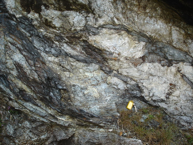
The rocks at Catpund began as olivine-rich lavas erupted onto the floor of the Iapetus Ocean about 580 million years ago. As that ocean closed they were metamorphosed by circulating hot fluids, the olivine altering to serpentine and ultimately to talc. Rock composed mainly of talc is soapstone or steatite — in Shetland, from the Old Norse, kleber. It is the softest mineral known, so it can be carved with simple tools when freshly exposed; it hardens on exposure to air or heat, expands little on heating and can be heated and cooled without shattering, which is what made it worth quarrying for cooking vessels and lamps.
Workings
Open working of the outcrop rather than anything underground, extending along both sides of the Burn of Catpund and its tributaries for close to a kilometre, from the hills down towards the shore. The remains take several forms: chisel marks on rock surfaces; the marks of items already cut out; incomplete and undetached artefacts still attached to the rock; quarry pits; and spoil tips beside them, which have yielded artefacts discarded during manufacture. The scheduled area covers about 74 per cent of the known ancient workings, the rest being scattered thinly over the hillside to the north.
Closure
The workings span roughly 2000–500 BC and then the Norse and medieval periods, with the Norse phase dominant. No source fixes a date at which quarrying stopped; the post-medieval farm structures among the workings show the ground remained in use for other purposes.
What remains
A Scheduled Monument, scheduled on 6 April 1987 (Historic Environment Scotland SM4521). The workings are open ground on a hillside, reached by a track from the A970 south of Cunningsburgh. Chisel marks, the hollows left by extracted bowls, partially cut blocks never detached, and mounds of waste chippings flanking the burn gully are all still clearly visible; a fenced area protects the densest concentration. Landslides in 2003 changed the topography, burying some archaeology and exposing new areas as the burn shifted its course.
Extensive and unusually legible: tool marks, bowl-shaped depressions and protruding boss marks densely covering the bedrock, unfinished and broken vessels left where they failed, and spoil mounds along the burn.
Nearby mines
- Sandlodge Mine — 6.4 miles (10.2 km) S
Straight-line distance, within 9 miles (15 km). Show on the map.
Recorded claims
Individual factual claims, each attached to the source(s) that support it below. Where sources disagree, both are kept.
- Catpund is the largest soapstone quarry in Britain and one of the largest in the world, its workings extending almost a kilometre along the Burn of Catpund. 1,2
- The outcrop was exploited between about 2000 and 500 BC and again in the Norse and medieval periods, the Norse being the main phase, when Catpund was the principal source of steatite west of the North Sea. 3
- The workings were scheduled on 6 April 1987 as Historic Environment Scotland monument SM4521; the scheduled area covers about 74 per cent of the known ancient workings. 3
- An excavation in 1988 revealed part of the quarry floor including the hollows left by over a hundred soapstone vessels. 1,2
- Norse workers produced bake plates, loom weights, fishing weights, oil lamps, spindle whorls and bowls; comparable vessels were found in the 12th- and 13th-century Norse levels at Jarlshof, and Catpund-type items occur at Norse sites across Britain and Ireland. 1,2
- Vessels were roughed out at the quarry rather than as blocks taken away whole, because flaws in the steatite made breakage likely; the rock's natural cleavage made the square and rectangular vessels characteristic of the late Norse period easier to produce than rounded bowls. 2
- Landslides in 2003 altered the site's topography, covering some archaeology and exposing new areas as the burn adjusted its course. 2
Photographs & further reading
A site account of what is actually visible on the ground — tool marks, unfinished and broken vessels left in place, and the effect of the 2003 landslides on the workings.
View sourceExplains how the steatite formed from Iapetus Ocean lavas and why its physical properties made it worth quarrying, with directions to the workings.
View sourceSources
- (secondary) Catpund soapstone quarry — Geopark Shetland
- (observational) Site in Focus: Catpund Steatite Quarry — Archaeology Shetland
- (primary) Cunningsburgh, steatite workings north and south of Catpund Burn (Scheduled Monument SM4521) — Historic Environment Scotland
- (primary) Catpund (Canmore / NRHE 924) — Historic Environment Scotland
- (secondary) Off the Beaten Track 7 — In search of soapstone — Shetland Amenity Trust
Record created: 3 September 2026 · Last researched: 3 September 2026