 MineArchive
Ballidon Quarry
| Location | Ballidon, near Parwich and Ashbourne, Derbyshire — 53.0961, -1.7017 (approximate) |
|---|---|
| Commodity | Limestone |
| Type | Quarry |
| Worked | Post-medieval–Still active |
| Maximum depth | Not applicable: an open quarry cut into the western side of Ballidon Dale. |
| Operators | Tarmac, Tilcon |
Overview
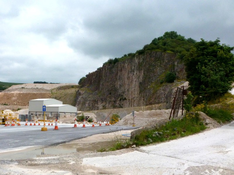
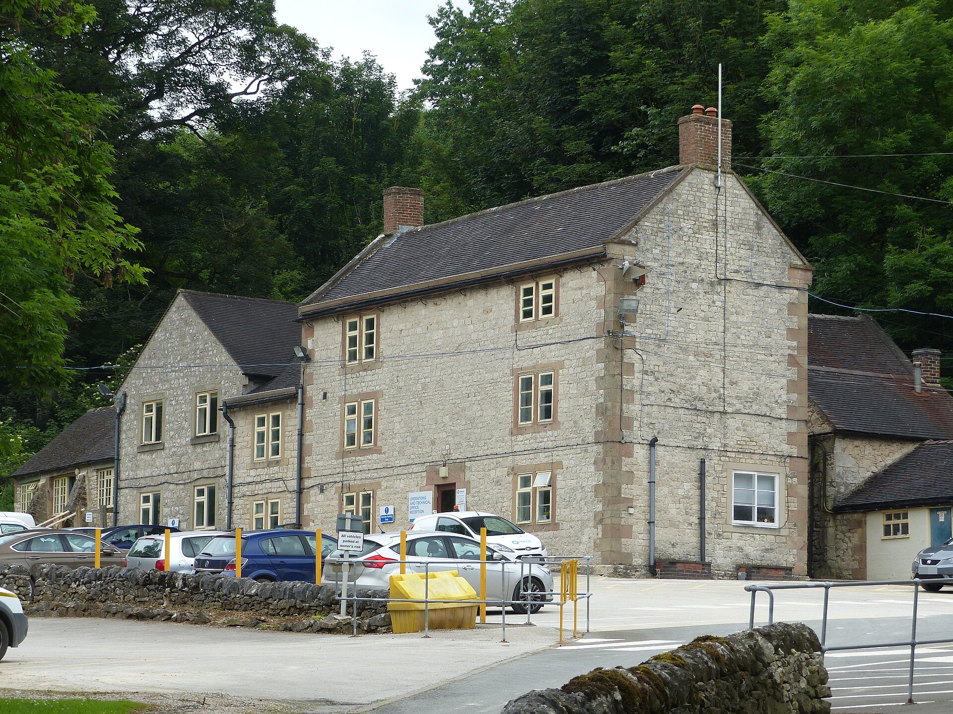
A working limestone quarry in the White Peak that has eaten the head of Ballidon Dale, taking Carboniferous limestone laid down in a warm shallow sea about 330 million years ago. It stands beside a designated Site of Special Scientific Interest and the earthworks of a deserted medieval village whose Anglo-Norman church still stands alone in a field, and its own offices occupy a listed eighteenth-century farmhouse.
History
Ballidon is an old place put to a modern use. The Anglo-Saxon estate here was granted by King Edgar in 963 and the village appears in the Domesday Book of 1086, when it was much larger than the handful of farmhouses left today; the earthworks and buried remains of the medieval settlement and its field system survive at the southern end of the dale as a scheduled monument, with the restored Anglo-Norman church of All Saints standing alone in a field where the village streets once ran. The deep valley that the quarry has taken was also the site of an ambush of troops during the Jacobite rising of 1745; skulls and weaponry were recovered from the west bank of the stream.
The quarry itself is recorded by the county's Historic Environment Record as a limestone quarry of the post-medieval period onwards, centred over an area some 718 metres by 505 metres. It has been worked in recent decades by Tilcon, whose offices occupied the mid eighteenth-century farmhouse now listed at grade two, and latterly by Tarmac. Archaeology has kept pace with the working: Neolithic or early Bronze Age flints, a scraper and a flake, and a sherd of Romano-British Derbyshire ware were collected by fieldwalking towards the rear of the quarry where stripping had cleared the topsoil, and Wardell Armstrong carried out a desk-based assessment and walkover survey for Tarmac in 2009 ahead of a proposed water discharge pipeline south of the quarry. Ballidon and the neighbouring Hoe Grange quarry now dominate the west side of the dale.
Geology
The quarry works Carboniferous limestone of the Brigantian stage, formed from deposits in a warm shallow sea about 330 million years ago and rich in fossils. Ballidon Dale itself is a steep-sided dry limestone valley about two and a half kilometres long, four hundred metres wide and a hundred metres deep, and is a Site of Special Scientific Interest for its geology and its limestone grassland, which carries early purple orchid, meadow oat, quaking grass, sheep's fescue and several sedges among the grasses, and salad burnet, bird's-foot trefoil, fairy flax, thyme and lady's bedstraw among the herbs.
Workings
An open limestone quarry centred over an area about 718 metres by 505 metres on the west side of Ballidon Dale, worked alongside the neighbouring Hoe Grange quarry. Its offices are in a mid eighteenth-century farmhouse, listed at grade two, which was in use as the Tilcon offices.
Closure
Still working. The Historic Environment Record dates the quarry broadly from the post-medieval period onward and notes that it is possibly still in use; the operators' own pages could not be read, so no year of first working and no output figures are recorded here.
What remains
A working quarry. It and Hoe Grange dominate the west side of the dale, while the protected dale itself, the scheduled medieval settlement earthworks and the isolated church of All Saints survive alongside; the Limestone Way passes just south of the hamlet.
Not a relic site: the quarry is active. The listed eighteenth-century farmhouse used as its offices is the oldest standing structure on the quarry ground.
Redevelopment
None; the quarry remains in production.
Nearby mines
- Carsington Pasture Lead Mines — 2.9 miles (4.6 km) E
- Golconda Mine — 3.0 miles (4.9 km) E
- Chariot Mine — 3.2 miles (5.1 km) E
- Rainslow Scrins — 3.2 miles (5.1 km) NE
- Gratton Dale Lead Mines — 3.3 miles (5.3 km) N
Straight-line distance, within 9 miles (15 km). Show on the map.
Recorded claims
Individual factual claims, each attached to the source(s) that support it below. Where sources disagree, both are kept.
- The Historic Environment Record classes Ballidon Quarry as a limestone quarry of the post-medieval period onward, centred over an area of about 718 metres by 505 metres, and notes that it is possibly still in use. 1
- Neolithic or early Bronze Age flints, one small scraper and one flake, and a sherd of Romano-British Derbyshire ware were collected by fieldwalking towards the rear of the quarry where stripping had cleared the topsoil. 1
- Wardell Armstrong carried out a desk-based assessment and walkover survey for Tarmac Ltd in 2009, ahead of a proposed 300 mm water discharge pipeline on land south of the quarry. 2
- The fossil-rich limestone was formed from deposits in a warm shallow sea in the Brigantian stage of the Carboniferous, about 330 million years ago; Ballidon Dale is a steep-sided dry limestone valley about 2.5 km long, 400 m wide and 100 m deep, and a Site of Special Scientific Interest. 3
- Ballidon was granted as an Anglo-Saxon estate by King Edgar in 963 and listed in the Domesday Book of 1086, and was once a much larger village; the earthworks and buried remains of the medieval settlement and its field system survive as a scheduled monument at the southern end of the dale. 4,3
- The deep valley now taken by the quarry was the site of an ambush of troops during the Jacobite rising of 1745, skulls and weaponry having been recovered from the west bank of the stream. 4
- The restored Anglo-Norman church of All Saints, redundant and listed at grade two since 13 September 1967, stands alone in a field on the site of the deserted village. 3,5
- Ballidon Quarry and the neighbouring Hoe Grange limestone quarry now dominate the west side of Ballidon Dale. 3,6
Photographs & further reading
The county record for the quarry, with its extent and the prehistoric and Romano-British finds recovered from behind the working face.
View sourceSources
- (primary) Derbyshire HER monument MDR8735: Ballidon Quarry, north-east of Oldfield Farm, Ballidon — Derbyshire Historic Environment Record
- (primary) Derbyshire HER source SDR24726: Tarmac Ltd, Ballidon Quarry archaeological assessment (Wardell Armstrong, 2009) — Derbyshire Historic Environment Record
- (secondary) Ballidon Dale (Wikipedia) — Wikipedia
- (secondary) Ballidon (Wikipedia) — Wikipedia
- (secondary) All Saints Church, Ballidon (Wikipedia) — Wikipedia
- (observational) Ballidon Quarry (Geograph photograph, 25 June 2012) — Geograph / Graham Hogg
Record created: 9 September 2026 · Last researched: 9 September 2026