 MineArchive
Felixstowe and Trimley Coprolite Diggings
| Also known as | Trimley Coprolite Pits, Suffolk Coprolite Diggings, Crag Pits |
|---|---|
| Location | Trimley St Martin, Trimley St Mary and Felixstowe, south-east Suffolk — 51.9889, 1.3112 (approximate) |
| Commodity | Coprolite |
| Type | Mineral |
| Worked | 1842–By 1880s |
| Maximum depth | Pits of 6 to 22 ft are recorded around Grimston Hall in 1874; White's Directory of 1885 describes whole fields turned over to 30 or 40 ft |
| Operators | William Colchester (1845–1880) |
Overview
An extractive industry run by farm labourers in ordinary fields, digging nodules that were not what anybody thought they were, to make a fertiliser nobody had made before. The Suffolk coprolite diggings turned over whole parishes, put the surface soil back afterwards, and left almost no trace except a street name in Ipswich and a nickname for the people of Trimley.
History
In 1842 the Reverend John Stevens Henslow — Cambridge professor of botany, and Charles Darwin's teacher — noticed dark nodules weathering out of the Red Crag cliffs on the south-east Suffolk coast near Felixstowe. He took them for coprolites, the fossilised dung of prehistoric marine animals, and recognised that they were rich in phosphate. Treated with sulphuric acid, they yielded superphosphate: the first artificial chemical fertiliser, arriving exactly as British farming was looking for one. Commercial digging began around Felixstowe from about 1845, with the Ipswich merchant William Colchester among the first to buy the material in quantity, and spread across the Colneis and Wilford hundreds over the following decades. It reached the Trimley parishes late: the earliest reference to pits there is in the early 1870s, with a geological account of 1874 describing a newly opened working near the railway about a mile north-west of the Trimley churches. It stayed small there — the 1881 census records only five men at it, all locals from Lower Street in Trimley St Martin, the eldest Daniel Brown at forty and the youngest Henry Collins at twenty-two. By 1885 White's Directory was reporting that the agricultural depression had slackened the manufacture of artificial manures and the raw material no longer had a very ready sale. Suffolk pits limped on into the early 1890s; the Trimley workings appear to have gone before that.
Geology
The phosphatic nodules lie in a thin bed at the base of the Pliocene Red Crag, resting on the London Clay beneath it. They are not, for the most part, fossilised dung at all: most are phosphatised fragments of older rock and fossil material, derived from the London Clay and concentrated at the base of the Crag by marine reworking — heavy, durable material left behind as lighter sediment was carried away. Thickness varied enormously over short distances. In one 1874 pit near the railway north-west of the Trimley churches the phosphate bed was up to three feet thick under only four to six feet of Crag, which made it very profitable ground; a working three-quarters of a mile away had the same seam at six inches under as much as seven feet of cover, which did not.
Geological setting: Placer Deposits (well documented example)
Workings
These were shallow open pits, not mines. The overlying Crag was stripped, the nodule bed lifted, and the material washed and barrowed out — work done by agricultural labourers with hand tools, taken up in the slack season when farm labour was cheap. Around Grimston Hall, half a mile west of Trimley, four separate workings were open in 1874, ranging from six feet deep to twenty-two feet in the pit then in full work, and the bed was worked again near Fagbury Cliff. The 25-inch Ordnance Survey of 1881 still showed two coprolite pits at work in Trimley St Martin, at the end of Common Lane. White's Directory of 1885 describes the system plainly: whole fields regularly turned over, sometimes to thirty or forty feet, usually by the tenant, who paid the landlord a royalty per ton and carted the nodules to the nearest town or wharf when his horses were free. Crucially, the surface soil was carefully set aside at the top and put back, so the land came out of it undamaged — which is why almost nothing of the industry survives to be seen. From the coast the material went by barge up the Orwell to the manure works at Ipswich.
Closure
The industry was killed by economics rather than by exhaustion. The agricultural depression cut demand for artificial manures through the 1880s, and cheaper imported phosphate rock made the Suffolk beds uncompetitive. Exactly when the Trimley pits stopped is not recorded; some Suffolk workings lasted into the early 1890s.
What remains
Farmland, with essentially nothing to see. The pits were backfilled and the preserved topsoil replaced as a condition of the working, and the land went straight back into cultivation. The industry's most durable remains are linguistic: Coprolite Street in Ipswich, beside the docks where the nodules were landed and where Fisons later refined them, and the nickname 'treacle miners' still attached to the people of the two Trimley parishes.
None identified on the ground. Coprolite Street in Ipswich, by the former manure works at the docks, is the industry's most visible surviving mark.
Redevelopment
The dug ground was restored to agriculture at the time of working and remains farmland; part of the Fagbury area was later taken by the expansion of the Port of Felixstowe.
What's uncertain
Points where sources disagree or the record could not be settled; both accounts are kept. All open questions in the archive.
- White's Directory reported in 1885 that the agricultural depression had slackened the manufacture of artificial manures and the raw material no longer had a ready sale; some Suffolk pits stayed in operation until the early 1890s, but nothing is recorded of when the Trimley workings stopped. (uncertain) 1,2
Recorded claims
Individual factual claims, each attached to the source(s) that support it below. Where sources disagree, both are kept.
- The Reverend John Stevens Henslow identified phosphatic nodules in the Red Crag cliffs near Felixstowe in the early 1840s; treated with sulphuric acid they yielded superphosphate, the first artificial chemical fertiliser. 1,2
- Digging began around Felixstowe about 1845, but there is no evidence of it extending into the Trimley parishes until the early 1870s, with a geological account of 1874 describing a newly opened working about a mile north-west of the Trimley churches, close to the railway. 1
- The phosphate bed varied sharply over short distances: up to three feet thick under four to six feet of Crag at the 1874 pit near the railway, but only six inches under as much as seven feet of cover three-quarters of a mile away. 1
- Four workings were open around Grimston Hall in 1874, from six feet deep to twenty-two feet in the pit then in full work; White's Directory of 1885 describes whole fields regularly turned over, sometimes to thirty or forty feet, with the surface soil carefully preserved so the land was not materially damaged. 1
- The 1881 census records only five men employed in the Trimley diggings, all living on Lower Street in Trimley St Martin, the eldest Daniel Brown at forty and the youngest Henry Collins at twenty-two. 1
- White's Directory reported in 1885 that the agricultural depression had slackened the manufacture of artificial manures and the raw material no longer had a ready sale; some Suffolk pits stayed in operation until the early 1890s, but nothing is recorded of when the Trimley workings stopped. (uncertain) 1,2
Photographs & further reading
Mining History (PDMHS Bulletin 14-5) — the standard published account of the industry as a whole.
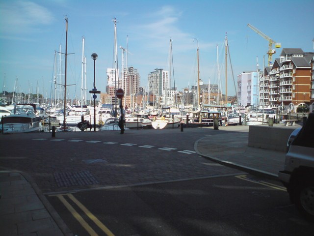
View sourceThe street by the docks named after the trade, where the nodules were landed and refined.
View sourceSources
- (secondary) Trimley, Suffolk — the coprolite diggings — Bernard O'Connor
- (secondary) Coprolite — Wikipedia
Record created: 25 August 2026 · Last researched: 25 August 2026