 MineArchive
Binley Colliery
| Location | Binley, Coventry, Warwickshire — 52.3911, -1.4438 (approximate) |
|---|---|
| Commodity | Coal |
| Type | Coal |
| Worked | 1907-1911–1963 |
| Maximum depth | Unknown. |
| Operators | Binley Colliery Company Ltd (?–1947), National Coal Board (1947–1963), Merry & Cuninghame |
Overview
A Warwickshire coalfield colliery on the eastern edge of Coventry, founded by Merry and Cuninghame and working from about 1911 to 1963 with up to 958 people; it turned Binley into a pit village, and its site is now an industrial estate and the Claybrookes Marsh nature reserve.
History
Binley Colliery lay at Binley, about three miles east-south-east of Coventry, with its entrance on Willenhall Lane. Accounts give its start as 1907, 1908 or 1911, the year it began producing coal. Merry and Cuninghame Ltd sank it, and the Binley Colliery Company Ltd later owned it. It brought new life to a quiet village: a special village was built for the miners, who numbered 474 in 1924 out of a population of just over 800, and pit cottages survive along Willenhall Lane and St James Lane.
The colliery employed 450 in 1923, 545 in 1933, 670 in 1940 and 680 in 1947, when it raised 250,000 tons. It was modernised in the 1950s, when it was at one time the most efficient and prosperous colliery in the Warwickshire coalfield, employing 958 in 1950 and working the Ryder, Slate and Two Yard seams for household, manufacturing and steam coal.
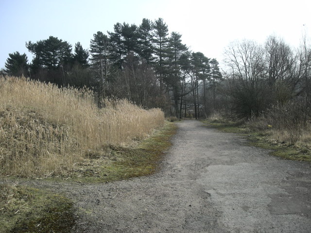
It closed in 1963. The site lay derelict until the Herald Way industrial estate was built on part of it; on the rest, after local opposition to a business park, Claybrookes Marsh nature reserve was made, named after two miners who died when the colliery roof collapsed. Closes on the Ernesford Grange estate are named after well-known local miners.
Geology
The Ryder, Slate and Two Yard seams of the Warwickshire coalfield.
Workings
Unknown.
Closure
The colliery closed in 1963.
What remains
The site is occupied by the Herald Way industrial estate and Claybrookes Marsh nature reserve.
Pit cottages on Willenhall Lane and St James Lane.
Nearby mines
- Wyken Colliery — 3.9 miles (6.3 km) N, West Midlands
- Exhall Colliery — 5.6 miles (9.0 km) N
- Coventry Colliery — 5.8 miles (9.3 km) NW
- Charity Colliery — 6.2 miles (10.0 km) N
- Newdigate Colliery — 7.0 miles (11.2 km) N
Straight-line distance, within 9 miles (15 km). Show on the map.
What's uncertain
Points where sources disagree or the record could not be settled; both accounts are kept. All open questions in the archive.
- Binley Colliery is dated from 1907 by the Coventry Society and 1908 by Wikipedia, and began producing coal in 1911. (disputed) 1,2,3,4
Recorded claims
Individual factual claims, each attached to the source(s) that support it below. Where sources disagree, both are kept.
- Binley Colliery is dated from 1907 by the Coventry Society and 1908 by Wikipedia, and began producing coal in 1911. (disputed) 1,2,3,4
- A village was built for Binley's miners, who numbered 474 in 1924 out of a population of just over 800. 2
- Binley Colliery employed 958 people in 1950, working the Ryder, Slate and Two Yard seams. 5,6
- Binley was at one time the most efficient and prosperous colliery in the Warwickshire coalfield and was modernised in the 1950s. 3,4
- Binley Colliery closed in 1963; its site holds the Herald Way industrial estate and Claybrookes Marsh nature reserve. 1,2,3
Photographs & further reading
An oral history project collecting residents' memories of the colliery and its site.
View sourceSources
- (secondary) Memories of Binley Colliery (University of Warwick Oral History Network) — University of Warwick
- (secondary) Binley (Coventry Society neighbourhoods) — The Coventry Society
- (secondary) Binley, Warwickshire (Wikishire) — Wikishire
- (secondary) Binley, Coventry (Wikipedia) — Wikipedia
- (primary) Binley Colliery — Durham Mining Museum
- (primary) BGS / Mining Remediation Authority mine plan 21828243: Binley, Ryder — British Geological Survey
Record created: 23 October 2026 · Last researched: 23 October 2026